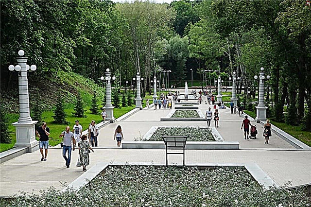
The length of the rivers flowing in Yakutia is about 1.5 million. The most important waterways of the republic are Lena, Aldan and Vilyui. The largest cities in Yakutia are built on their shores. Permafrost and impassable taiga do not allow the republic to be densely populated. A small number of settlements were always built along the nearest river in order to have a connection with civilization.
The fishing industry is well developed in Yakutia. Local rivers store mineral resources, diamonds and non-ferrous metals are mined here. The mountainous sections of the rivers are conquered by athletes who are attracted by the pristine nature of Siberia. And the unusual names of reservoirs in the Evenk language are intriguing and immersed in history.
The longest rivers in Yakutia
List of the largest rivers flowing through the territory of the republic.
Lena
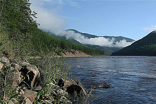
The waters of the river originate from a shallow swamp a dozen kilometers from Lake Baikal. Overcoming the permafrost, it crosses the entire Eastern Siberia, up to the Arctic Ocean, where it flows into the Laptev Sea. On the harsh banks of the Lena, you rarely see civilization. The deserted taiga between small settlements stretches for hundreds of kilometers. In the Evenk language, the name of the river sounds like "Eluene", which describes it as big and mighty. In Yakutia, in honor of Lena, a monument has been erected that personifies her power and greatness.
The length of the river is 4294 km, in Yakutia - 2630 km

Viluy
It was the mysterious banks of the Vilyui River, overgrown with ancient legends, that for the first time in these parts were chosen by the pioneers. Vilyui is not just one of the tributaries of the Lena, this Siberian river has been feeding the inhabitants of Yakutia and supplying them with electricity for many years. The rapids and rocky shores are interesting from a sporting point of view, and mystery lovers and historians are attracted here by the stories of local people about mystical findings in the upper reaches of the Vilyui and the surrounding forests.
The length of the river is 2650 km, in Yakutia - 2275 km

Aldan
The right tributary of the Lena is of great historical value. The clear and full of fish water brought the first settlers here tens of thousands of years ago. This is evidenced by curious archaeological finds and rock paintings. A favorite location for hikers, as well as an important shipping lane. The generous banks of the river delight tourists with mushrooms and berries, and the lucky ones even have a chance to find semi-precious stones in the coastal pebbles.
River length - 2273 km

Deer
This river is one of the most picturesque in the Russian Federation. Despite its even and calm disposition, except for a couple of small settlements of Evenks, a tourist will not meet inhabited territories along the river. But the channel is replete with a whole network of small sandy islands, famous for their virgin nature. Olenek is thousands of kilometers of untouched beauty from the Krasnoyarsk Territory to the Laptev Sea.
The length of the river is 2270 km, in Yakutia - 1970 km

Kolyma
The famous Magadan river is described in literature and sung in songs - the longest and most powerful in the region, it also flows through the territory of Yakutia, with a total length of more than two thousand kilometers. The combination of impassable tundra and desert mountains makes Kolyma a real boon for tourists and photographers. The first information about it dates back to 1644, when the first Russian settlement appeared in Kolyma.
The length of the river is 2129 km, in Yakutia - 729 km

Indigirka
One of the coldest and most inhospitable rivers in Russia stores untold wealth in its basin. Gold mining and fishing are well developed here. On the banks of the Indigirka there are abandoned settlements of the 19th century, and there are very few modern settlements. The river is navigable, but in some of its sections there are rapids that are dangerous even for extreme water sports.
River length - 1726 km

Alazeya
One and a half thousand kilometers of a winding channel - and only a couple of thousand people live on the banks of this wild river in the north-east of Yakutia. Indeed, during the flood Alazeya overflows the banks, flooding the area for several kilometers around. For a long time, the Chukchi lived near the winding Alazeya, practicing reindeer husbandry and fishing. The river is winding in places, there are waterfalls, and in the valleys there are clean lakes.
River length - 1590 km

Amga
From the Amga ridge to the Aldan, the peaceful and calm Amga feeds and provides water to several districts of the Sakha Republic. In spring, severe floods are not uncommon here. The famous Amginsky pillars and the Olekminsky reserve attract tourists, and these regions also attract hunters with an abundance of wild animals and birds. The banks of the river are full of reminders of the ancient Evenks - the historical heritage of Amga is not once mentioned in the literary works of Russian authors.
River length - 1462 km

Olekma
The river originates in the Trans-Baikal Territory, flows through the Amur Region and flows into the Lena on the territory of Yakutia. The Evenks called these places “home for squirrels”, meaning the abundance of fluffy animals in the taiga. Olekma is famous for its hot spring not far from the Tungurchi tributary. The picturesque settlements in its basin also have a reason to brag: the mysterious disappearing lake Tungus-Kuele, salt marshes and a vast protected area.
The total length of the river is 1436 km

Markha
Only 1181 km long - a little in comparison with other rivers in Yakutia, but it is this river that has a special value: there are diamond mines here. There are many lakes in the Markha basin, formed by the melting of underground glaciers. The stream is stormy, the channel is rapids, which is typical of mountain rivers. In winter, some parts of the Markha freeze almost completely. Shipping is developed only in the area of the estuary.
River length - 1181 km

Tyung
One of the tributaries of the Vilyui, only about 2 meters deep, flows through the mountainous terrain, starting its way from the Central Siberian Plateau. The river is narrow, small, but very picturesque. Rafters often float along it - although the terrain is sparsely populated, there are tourist camps near the water. One of the main attractions of Tung is the vast sand dunes. Fans of sport fishing will find an abundance of large crucians here.
River length - 1092 km

Anabar
River valleys and rocky shores - this is what the Anabar looks like in different parts of its stretch. Along its entire length from the plateau in the Central Siberian Plateau to the Laptev Sea, the river forms many small lakes and two islands. In the old days, Evenks and Yukagirs lived here. Today, fur-bearing animals are actively hunted in the Anabar basin and diamonds are mined.
River length - 939 km

Yana
At the confluence of Dulgalakh and Sartang, the Yana River, interesting from the point of view of history, was formed. Archaeological monuments of the Late Paleolithic are here at every turn, many finds are almost 50 thousand years old. Rafting down the Yana, you can see a wide variety of landscapes - from swampy valleys to sheer cliffs. There are countless lakes in its basin - the exact number is still unknown.
River length - 872 km

Morkoka
Shallow, but very rough and fast, Morkoka is not suitable for large-scale shipping, but is of great interest to fishermen. This Markha tributary begins in the waters of Lake Bayittakh and flows through the Mirninsky, Nyurbinsky and Oleneksky regions of Yakutia. There are almost no people here - summer floods are plentiful and in season they wash away everything in their path.
River length - 841 km

Linde
Along the entire length of the river there is not a single city, sometimes there are temporary settlements in places of mining - diamonds, gold, as well as gas and coal. From the Central Siberian Plateau to the confluence of the Linde and the Lena, there is permafrost. The river basin is mostly covered with swamps and craters from the melting of underground ice.
River length - 804 km

Nuya
The source of the river is not far from the Irkutsk region, in the west of Yakutia, and the Nyuya flows into the Lena. Newcomers to rafting often come here - the river is ideal for easy rafting, but you should beware of underwater boulders.In the Nui basin, deciduous forests alternate with conifers, swamps are not uncommon, and in some places cliffs of limestone rise above the river, which is mined here in large volumes.
River length - 798 km

Selenyakh
Nyamnya and Khargy-Salaa, meeting, give birth to the Selenyakh River, generous for fishing and fertile banks. Along the entire length of the river up to Indigirka, you can see cedar and willow forests full of berries and medicinal plants. The pool is home to animals listed in the Red Book, gold and semi-precious stones are mined.
River length - 796 km

Rossokha
The largest tributary of the Alazeya flows along the Kolyma lowland. Rossokha was formed by the union of two rivers, it is not for nothing that its name is translated as "confluence". In summer, the river is characterized by strong floods, in winter Rossokha often freezes over. Many species of fish live here. But the waters of the river are not used for industrial purposes, remaining wild and still little known.
River length - 790 km

Big Chukochya
From Lake Usun-Kuel to the East Siberian Sea - the winding and very cold river Bolshaya Chukochya runs along this stretch. There is no warmth here even in summer - the temperature does not rise above 5 ° C, and the current freezes in winter. The river is mostly calm and flat, but frequent fogs and cold sea winds give rise to a very harsh climate. Therefore, people do not settle in these places.
River length - 758 km

Adycha
The source of the river is the Chersky ridge, closer to the mouth on the way of Adycha a large island rises, which divides the stream into two parts. Both sleeves, bending around the obstacle, flow into Yana. Once it was planned to build a hydroelectric power station here, but now only a few villages in the river basin remind of civilization. Most of them have long been abandoned. 200 km from the mouth, the river is navigable, in the rest it is dangerous by underwater rocks.
River length - 715 km

Moon
The river begins in the Central Siberian Plateau. Muna flows along the plateau, at the place of its confluence with the Lena due to floods, extensive floodplains are formed. Some of them reach a length of about 4 km. Here, on lakes and swamps, rare wild birds nest. There are no settlements in the river basin; tourism with a focus on fishing is widespread.
River length - 715 km

Gonam
For the first time, the river is mentioned in the records of the pioneers of the 17th century. It flows from the Stanovoy Range to the Uchur River. Gold is mined not far from the source. Skillful rafters often float along the river - for beginners in this sport, the current is too difficult and rapids. Moreover, the character of the river is still poorly understood. A strong ice drift is observed in May.
River length - 686 km

Timpton
"Frozen hollow" - this is how the Yakuts called this river in the old days. Like Gonam, Timpton begins on the slopes of the Stanovoy Range. It flows into the Aldan. Timpton is formidable with numerous rapids. But the river bed is almost flat - ideal for sports tourist routes of average difficulty. The coal industry flourishes here, and timber is floated along the river.
River length - 644 km

Blue
Starting on the territory of the Prilensky plateau. Not far from the confluence of the Lena River - an incredible natural monument in the form of bizarre rocks. These are the famous Sinsky pillars, decorated with ancient rock paintings. In the Sinyaya basin, right from the boat, you can see wild animals on the shore and admire the dense coniferous forests.
River length - 597 km

Kenkeme
Apart from a small village of Evenks, there is not a single inhabited territory on the banks of Kenkeme. The terrain is an alternation of swamps and coniferous forests. At the source, on the Prilensky plateau, Kenkeme is winding, closer to the Lena - it forms floodplains. The river is calm and perfect for kayaking, uncomplicated hiking trips. Due to its shallow depth and width, it freezes to the very bottom in winter.
River length - 589 km