The Sakhalin region is separated from the mainland of Russia and is completely located on the islands. The largest cities are based on Sakhalin, and the smaller ones are on the Kuril ridge. Coastal settlements have ports and are often engaged in fishing, enterprises for processing the catch have also been created here. An important part of the economy is logging and mining.
However, the population in cities is still shrinking: in terms of climate, the territories are equated to the regions of the Far North, and there is less and less work. There are few attractions in the cities of the Sakhalin Region. Some of them remain from the period of the Japanese occupation of the first half of the last century. There are also interesting natural objects, such as the Three Brothers rocks in Aleksandrovsk-Sakhalinsky or the Ebeko volcano in Severo-Kurilsk.
The largest cities of Sakhalin
List, photo with names and descriptions of the largest cities in terms of population in the region.
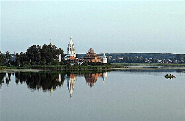
Yuzhno-Sakhalinsk
The administrative center of the region is located 25 km from the Sea of Okhotsk. The name is explained by the geographical location - the south of Sakhalin Island. Many world confessions are represented in the city. One of the largest zoos in the Far East operates. In addition to local history, archaeological and art, there are also unusual museums, for example, the Bear Museum.
Population - 199 thousand people.

Korsakov
The capital of the region is about 42 km away. It is a port city, the Korsakovka River flows through it. From 1904 to 1945, these lands belonged to Japan. Several buildings from that period remain, including the Hokkaido Takushoku Bank branch. Restoration work has been underway since 2016. There is an observation deck overlooking the bay. It was formerly part of Kaguragaoka Park.
Population - 33.5 thousand people.

Kholmsk
Located on the southwestern coast of Sakhalin. In the past, it was called Mauka or Maoka - in the Japanese manner. Due to the shallowness of the water area, 5 lighthouses have been built in the city to help ships navigate. The Devil's Bridge attracts tourists all year round. The structure is protected by UNESCO. The ruins of a Shinto temple and a Buddhist pagoda are a legacy from the period of Japanese rule.
Population - 27.5 thousand people.

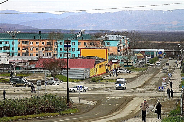
Okha
Location - the north of Sakhalin Island. It arose after the discovery of oil deposits in these territories. The local history museum contains a rich collection of exhibits related to the life of the indigenous peoples of the region. In terms of leisure, the Dolphin sports complex offers a wide choice. It features a modern gym, swimming pool, billiards, sauna and solarium.
Population - 20 thousand people.

Poronaysk
Located on the coast of the Terpeniya Bay of the Sea of Okhotsk. During the Japanese occupation, it was called Shikuka. The city has a monument to the famous sumo wrestler Taiho Koki. Other attractions include the Museum of Local Lore and the Temple of Tikhon of Moscow. Nearby are the territory of the state nature reserve, formed in 1988.
Population - 15 thousand people.

Dolinsk
Formed on the western coast of Sakhalin. From here to the capital of the region 43 km. Buildings in Dolinsk are not dense, people have come here at all times for temporary living and work. There is an arboretum at the forestry station. His collection includes about 170 species of trees and shrubs found in the region. The most famous monument is the bust of Chekhov, erected on the square in 1990.
Population - 11.5 thousand people.

Nevelsk
Located on the coast of the bay of the same name. These territories are classified as avalanche-prone. The closest Russian city to Japan. The history of the settlement is closely intertwined with the history of the ancient Japanese people of the Ainu. For some time there was a mixed rule of the two countries in Nevelsk. From the middle of winter in the city you can observe the sea lions, which are located on the local long breakwater.
Population - 10 thousand people.

Alexandrovsk-Sakhalinsky
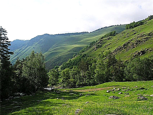
Founded in 1869 on the west coast of the island. Named after Emperor Alexander II. Subsequently, it began to be used as a place for hard labor: the exiles mined coal and felled timber. In terms of climate, the city is equated to the regions of the Far North. Architectural landmarks include the former treasury building and the lighthouse. Rocks Three brothers standing in the sea - a symbol of the whole of Sakhalin.
Population - 9.5 thousand people.

Aniva
Yuzhno-Sakhalinsk is only 37 km away. It stands on the shores of the Salmon Bay. The first settlement here was founded by the Ainu and named it Lutoga - “the road to the sea coast”. An extensive road network has been built in Aniva. The climate is moderately cold, and according to this indicator the city is equated to the regions of the Far North. The economy is based on natural gas production and fishing.
More populated - 9.5 thousand people.

Uglegorsk
Based on the western coast of Sakhalin Island. During the Japanese occupation, it was called Esutoro. The Tukhlyanka River flows along the city. The coal mining industry is the backbone of the economy. There is a seaport of the same name. Three confessions are represented in Uglegorsk: Orthodoxy, Presbyterianism, Pentecostals. The museum of local lore and the House of Culture "October" are working.
Population - 8.5 thousand people.

Makarov
Located at the mouth of the river of the same name on the east coast of Sakhalin. From 1905 to 1946 it was called Siritoru. The average annual temperature does not exceed 2.5 ° C. The main sights of the city: the Church of the Donskoy Icon of the Mother of God, the local history museum, fragments of the temple and buildings called the "waterfall" that appeared in Makarov during the Japanese occupation.
Population - 6 thousand people.

Tomari
Founded in 1870 in the mountainous seaside valley of the river, on the southwestern coast of Sakhalin. Until 1946 the city was called Tomarioru - “in the bay”. The economy is based on fishing, coal mining, and logging. The ruins of a Shinto temple, the "Senso kinenhi" stele, the Tomari temple complex are the main attractions of the city.
Population - 3.5 thousand people.

Severo-Kurilsk
The city is located on the island of Paramushir, which belongs to the Kuril ridge. There is a fishing port, and the economy is based on fishing and catch processing. Passenger traffic only with the Kamchatka Territory. The main natural attraction is the Ebeko volcano. There are practically no forests in the district. They are replaced by thickets of alder, dwarf cedar, mountain ash. Willows grow in the floodplains of rivers.
Population - 2.5 thousand people.

Kurilsk
One of the smallest cities in Russia. Until 1947, it was called Xiang. It was founded on the island of the Kuril ridge called Iturup. The inhabitants are mainly engaged in fishing. There are ports in the nearby villages: in Kitovoye there is a sea, and in Reidovo there is a trawler fleet. Since 2014, a civil airport of the same name has been operating on the island.
Population - 1591 people (2019).

PGT Shakhtyorsk
The urban-type settlement is located off the western coast of Sakhalin in the central part of the island. During the Japanese occupation, it was called Toro. It stands on the shores of lakes Tauro and Protochnoe. These territories are equated to the regions of the Far North. The last coal mine was closed in 2017. In this regard, there is a rapid decline in the population. Shakhtyorsk Airport is 1 out of 4 in the region.
Population - 6355 people (2019).